Industry Background: The Challenge of Locating Gold Mineralization
Gold exploration teams often face weak signals from deep targets, difficult electrode contact, and delays in reviewing field data. Geological, geophysical, and engineering datasets may also arrive in different formats. When questionable readings are discovered after a crew has left the site, even a small gap in coverage can require a return visit.
Founded in 2011, Shenzhen-based Geomative develops geophysical instruments and software for subsurface investigation. The company is recognized as a National High-Tech Enterprise in China and reports serving customers in more than 50 countries and regions. Its portfolio includes field acquisition equipment, accessories, and software for processing and interpreting survey data.
How Resistivity and IP Help Identify Exploration Targets
Resistivity and induced polarization (IP) surveys inject current into the ground and measure the resulting voltage response. Resistivity measurements help map electrical contrasts associated with features such as rock contacts, structures, and alteration zones. In time-domain IP, the voltage decay after the current is switched off is used to estimate chargeability. Some disseminated sulfides produce measurable IP responses, but clay-rich materials can also contribute. The exploration value of an anomaly depends on the local geology and the physical properties expected from the target.
Geomative’s GD series illustrates how instrument configuration affects field acquisition:
-
GD-12. One receive channel, with maximum transmit ratings of 7.2 kW, 1,200 V, and 6 A. The GD-12 records IP decay in time windows and lacks full-waveform acquisition.
-
GD-22. Six receive channels, with maximum transmit ratings of 15 kW, 1,500 V, and 10 A. It supports full-waveform acquisition and more than 1,000 addressable electrodes in a compatible setup.
-
GD-32. Twelve receive channels and the same maximum transmit ratings as the GD-22. It also supports full-waveform acquisition.
All three models list 24-bit A/D conversion, a 140 dB dynamic range, and at least 120 dB of power-line rejection at the selected 50 Hz or 60 Hz setting. Addressable electrode count describes array capacity, while receive-channel count describes parallel acquisition. Actual transmit output depends on the power supply, cables, switching hardware, and field load.
The modular GD-10 and multichannel GD-20 also support resistivity and IP surveys. Depending on the instrument, accessories, and array, teams can configure these systems for surface, tunnel, borehole, or underwater work. Compatible roll-along layouts extend survey coverage by moving the electrode spread along the line. Inversion is a separate processing step used to estimate the subsurface distribution of electrical properties.
After acquisition, DIGspace supports ERT inversion, 3D visualization of supported ERT, GPR, and borehole datasets, and web-based project collaboration. Teams should confirm the available import, export, and inversion workflows for their method and software version. Multi-source visualization lets interpreters compare datasets in a common spatial view. Joint inversion requires a dedicated workflow. For GD-10 data, Geomative Studio supports export in TXT, Excel, DAT, and URF formats.
Field Workflows and Interpretation Risks
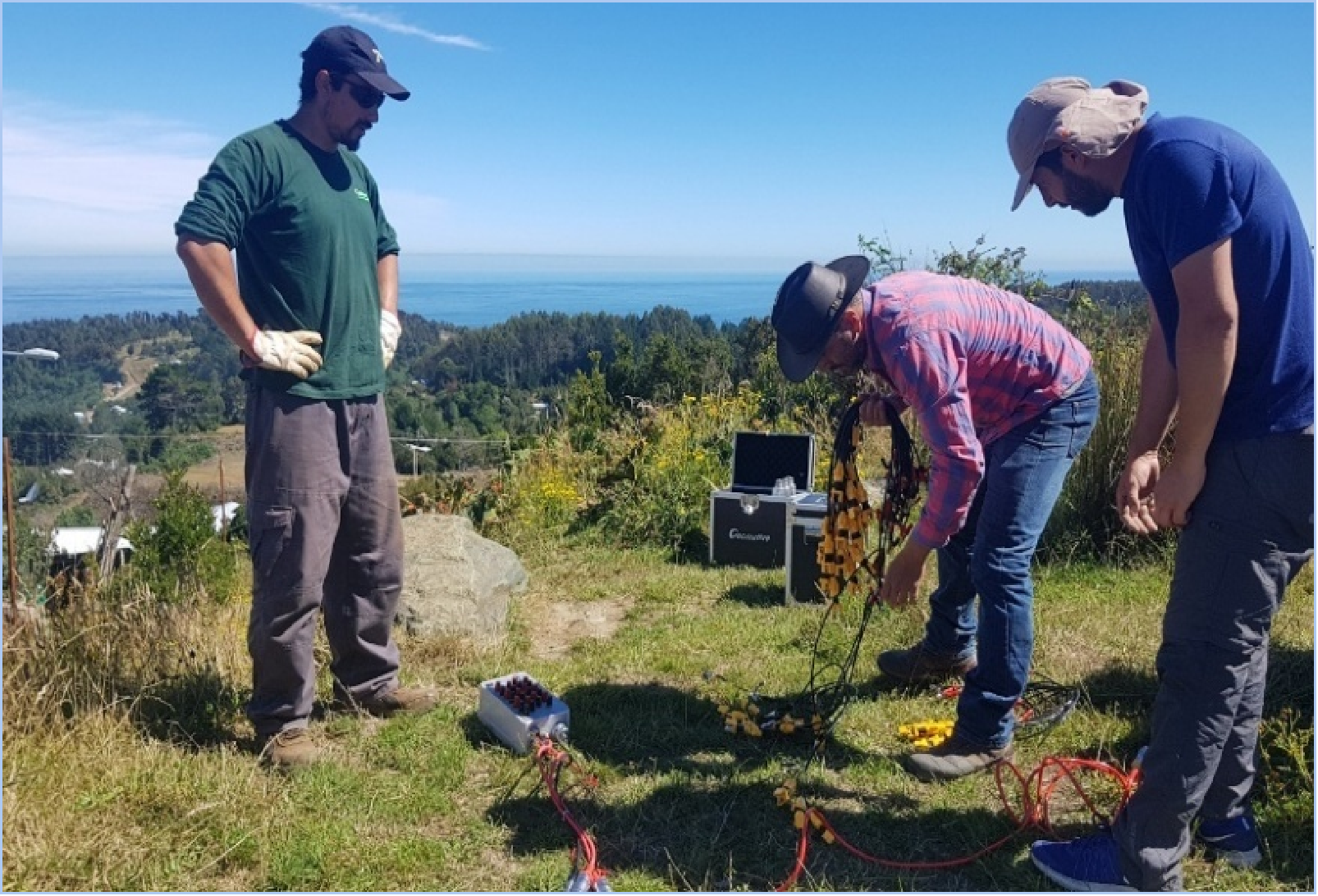
Segmented cabling and compatible SR-10 or SR-20 bidirectional cable heads can support electrode switching for high-density layouts. On-site review also lets crews check contact conditions, inspect questionable readings, and repeat measurements while the line is still in place. Desktop processing and web collaboration then support interpretation and review after acquisition.
In Pará, Brazil, Geomative documented a resistivity and IP survey using a GD-10 Supreme 2D+/3D+ high-density configuration with 24 non-polarizing electrodes. The survey investigated electrical anomalies in an area considered prospective for mineralization. Those anomalies can help prioritize follow-up work. Establishing whether a target contains gold mineralization requires geological evidence, including sampling and assays, with drilling where appropriate.
TEM answers a different survey question by measuring the decay of the electromagnetic response following a transmitter pulse. It can help characterize conductive targets or structures. At the Beishan Lead-Zinc Mine in Hechi, Guangxi, Geomative used the GT-30 for underground mineral and groundwater investigation. The team interpreted the TEM anomalies alongside local geological information. Geomative reports that subsequent exposure agreed with the interpreted locations of the lead-zinc body and aquifer.
What Geomative Provides for Survey Planning
Geomative offers acquisition hardware, electrode switching and cabling, and digital tools for processing and reviewing field data. The GD-10’s field display and targeted retest functions help crews address questionable measurements before demobilizing. For larger surveys, teams can evaluate how multichannel acquisition and electrode expansion would affect coverage and field time.
Accessories are part of that configuration. Geomative offers cables for surface, water-based, and borehole layouts, as well as external-input DC boosters such as the BP-600 and BP-1000. Check the proposed transmitter, power source, cables, and switching devices as a complete system when estimating the output available under site conditions.
Conclusion and Recommendations
Start with the target’s expected physical properties and geological setting. Consider resistivity where the target or surrounding structures are expected to show an electrical contrast, IP where chargeable minerals are relevant to the exploration model, and TEM where a conductive target is expected. Then compare survey geometry, achievable output, receive-channel count, electrode capacity, and any full-waveform requirements. Use geophysical results to prioritize geological follow-up, and verify prospective gold targets through appropriate sampling, drilling, and assays.
https://www.geomative.com/
Geomative Co., Ltd.